


We provide quality services using latest state-of-art technology instruments like 3D Terrestrial Laser Scanner / Differential Global Positioning System (DGPS) / Electronic Total Station & Drone with LIDAR as well as Photogrammetry. Our engineers are professionally trained to carry out projects with full satisfaction of the end user. Our activities are mainly focused in the following fields.
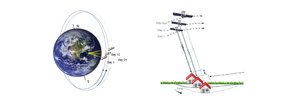
A cutting-edge technology using Satellite based RADAR (InSAR) for ground deformation measurement & monitoring from space. The technological advancement is used for detect and monitoring of land slide, dump/bench failure, unstable slope area and subsidence.
Based on the analysis of satellite images of the area of interest over time, we provide detailed information on ground movements, detecting precursors of instability and thus avoiding possible unwanted geotechnical events, such as dump/bench/slope failure and subsidence.
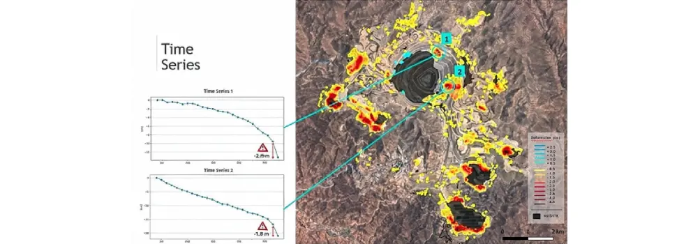
Historical Analysis: Thanks to the availability of historical data from ground deformation which helps to understand the behavior of ground deformation in the past.
Multispectral Analysis:
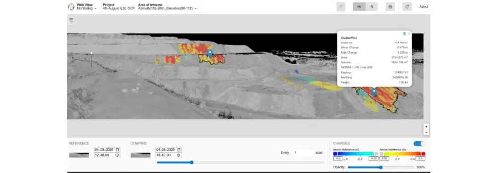
This advanced technology helps to identify hotspots within a large mining area and the nature of ground deformation with time. Hotspots located very close to active mining area are of concern for frequent monitoring or Real Time monitoring using 3D-Terrestrial Laser Scanner (3D-TLS).
Specialized 3D-TLS with Real Time monitoring capability are being used for continuous or periodic monitoring to ensure safety of human being and mining machinery.
Rainbow Technologies is providing complete solution for monitoring of mining areas using InSAR, a cutting-edge technology and advanced 3D-TLS for continuous or periodic monitoring of the concerned area.
All Right Reserved. Designed by InfoSky Solutions Best View : Fire Fox, Chrome, IE8+ 1024x768 Resulations